At
CSIRO (AU)-Commonwealth Scientific and Industrial Research Organization
1.13.23
Madeleine Clarke
What if we could take an MRI of the ocean and explore it in virtual reality? We’re prototyping tools to bring greater resolution to the study of the world’s oceans.
Our world’s oceans are teeming with life and data. It’s easy for scientists who study the ocean to become lost in a sea of endless numbers and graphs. It’s harder to find meaningful connections and patterns while drowning in data.
This is because the ocean is an infinitely complex, gigantic and multidimensional volume with length, width, and depth. It’s also important to consider that the ocean’s properties change by the second. Therefore, we now add an extra dimension into the mix: time.
Currently, properties of these four dimensions like temperature, salinity, velocity and sea level are largely mapped on flat two dimensional (2D) plots. Because of this, studying them requires a lot of mental gymnastics. As a result, our gymnasts (scientists) translate pages upon pages of graphs into dynamic, multidimensional meanings in their heads.
We think there’s a better way.
Meet Ocean Explorer
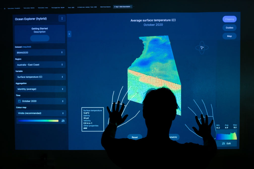
Design Thinking expert Viveka Weiley with an early version of the Ocean Explorer prototype.
Through a program called Reinvent Science, we’re prototyping tools to allow our scientists to dive with ease into multidimensional data.
Our Senior Software Engineer Emma Krantz and her colleagues are working on two versions of a tool called “Ocean Explorer”.
This tool aims to bring a greater resolution to the study of dynamic ocean variables, which will help to reduce the barriers between scientists and their data.
“What we’re trying to do is move from data visualizations, which are the equivalent of 2D CT scans, to something like an MRI of the ocean,” Emma said.
Ocean Explorer will work across two main versions. First, an immersive experience where researchers zoom, rotate, colour-code, and slice-and-dice an ocean volume. They will do this by wearing a virtual reality (VR) headset with augmented reality. With the headset on, users can submerge themselves beneath the ocean surface, exploring currents and other wonders in 4D.
Second: a web-based Ocean Explorer. This version allows researchers to manipulate high-quality data visualisations from a desktop computer.
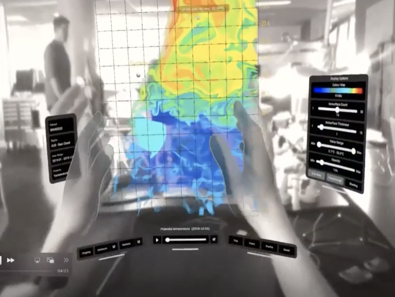
By visualizing ocean variables in augmented reality, we hope to bring our researchers closer to their data and closer to discovery.
Our science steering the ship
Physical oceanographer Ming Feng is the Science Lead for Ocean Explorer. He works to translate the science to the development team and ensure the tools will be useful and usable.
“Data in oceanography is often a bit opaque. To be able to quickly scan through ocean model data or observational data in 3D or 4D views would allow us to easily detect hidden signals,” Ming said.
“As many oceanography questions are multi-disciplinary, this tool could also help us to formulate a working hypothesis and eventually, with further development, evaluate model performances to address these questions.
“The tool will also be useful in communicating complex science with stakeholders and the general public.”
Floating ideas and grounding them in reality

Senior Engineer Emma Krantz and Design Thinking expert Viveka Weiley workshop an early version of the Ocean Explorer prototype.
The vision that inspired “Ocean Explorer” came from our researchers Beth Fulton and Peter Dobrohotoff. They imagined a world where they could feel their data and interact with it using more of their primary senses.
Our software engineers, designers, scientific computing experts, and product managers are currently working backwards from a transformative dream like this and taking realistic steps towards it. The aim: To get future technologies into the hands of our scientists today.
The current version of the tool is designed to visualize the BRAN2020 dataset, a key output of the Bluelink partnership between the Australian Department of Defence, Bureau of Meteorology and us. It provides realistic estimates of whole ocean attributes, based on a scientific model.
Recently, Ocean Explorer was demonstrated at SIGGRAPH Asia 2022 alongside global pioneers of computer graphics and emerging technology.
Program lead Viveka Weiley said the team is exploring how the tool could benefit other scientific domains.
“We’re beginning to see a path to solutions that can open up scientific fields to more people and create more opportunities to cross disciplinary boundaries,” Viveka said.
“And as we look into scaling Ocean Explorer beyond the current prototype, there’s potential for applications in other fields from atmospheric physics to geological exploration.”
See the full article here .
Comments are invited and will be appreciated, especially if the reader finds any errors which I can correct. Use “Reply”.

five-ways-keep-your-child-safe-school-shootings
Please help promote STEM in your local schools.
![]()
CSIRO (AU)-Commonwealth Scientific and Industrial Research Organization , is Australia’s national science agency and one of the largest and most diverse research agencies in the world.
CSIRO works with leading organizations around the world. From its headquarters in Canberra, CSIRO maintains more than 50 sites across Australia and in France, Chile and the United States, employing about 5,500 people.
Federally funded scientific research began in Australia 104 years ago. The Advisory Council of Science and Industry was established in 1916 but was hampered by insufficient available finance. In 1926 the research effort was reinvigorated by establishment of the Council for Scientific and Industrial Research (CSIR), which strengthened national science leadership and increased research funding. CSIR grew rapidly and achieved significant early successes. In 1949 further legislated changes included renaming the organization as CSIRO.
Notable developments by CSIRO have included the invention of atomic absorption spectroscopy; essential components of Wi-Fi technology; development of the first commercially successful polymer banknote; the invention of the insect repellent in Aerogard and the introduction of a series of biological controls into Australia, such as the introduction of myxomatosis and rabbit calicivirus for the control of rabbit populations.
Research and focus areas
Research Business Units
As at 2019, CSIRO’s research areas are identified as “Impact science” and organized into the following Business Units:
Agriculture and Food
Health and Biosecurity
Data 61
Energy
Land and Water
Manufacturing
Mineral Resources
Oceans and Atmosphere
National Facilities
CSIRO manages national research facilities and scientific infrastructure on behalf of the nation to assist with the delivery of research. The national facilities and specialized laboratories are available to both international and Australian users from industry and research. As at 2019, the following National Facilities are listed:
Australian Animal Health Laboratory (AAHL)
Australia Telescope National Facility – radio telescopes in the Facility include the Australia Telescope Compact Array, the Parkes Observatory, Mopra Radio Telescope Observatory and the Australian Square Kilometre Array Pathfinder.
 CSIRO Australia Compact Array (AU), six radio telescopes at the Paul Wild Observatory, is an array of six 22-m antennas located about twenty five kilometres (16 mi) west of the town of Narrabri in Australia.
 CSIRO-Commonwealth Scientific and Industrial Research Organization (AU) Parkes Observatory [Murriyang, the traditional Indigenous name], located 20 kilometres north of the town of Parkes, New South Wales, Australia, 414.80m above sea level.
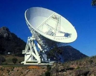
 NASA Canberra Deep Space Communication Complex, AU, Deep Space Network. Credit: The National Aeronautics and Space Agency
 ESA DSA 1, hosts a 35-metre deep-space antenna with transmission and reception in both S- and X-band and is located 140 kilometres north of Perth, Western Australia, near the town of New Norcia
 CSIRO-Commonwealth Scientific and Industrial Research Organization (AU)CSIRO R/V Investigator.
 UK Space NovaSAR-1 satellite (UK) synthetic aperture radar satellite.
CSIRO Pawsey Supercomputing Centre AU)
 Magnus Cray XC40 supercomputer at Pawsey Supercomputer Centre Perth Australia
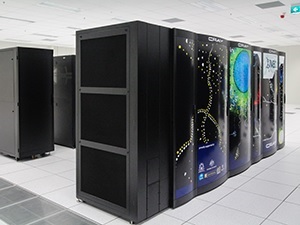 Galaxy Cray XC30 Series Supercomputer at at Pawsey Supercomputer Centre Perth Australia
 Pausey Supercomputer CSIRO Zeus SGI Linux cluster

Others not shown
Australia Telescope National Facility – radio telescopes included in the Facility include the Australia Telescope Compact Array, the Parkes Observatory, Mopra Radio Telescope Observatory and the Australian Square Kilometre Array Pathfinder.
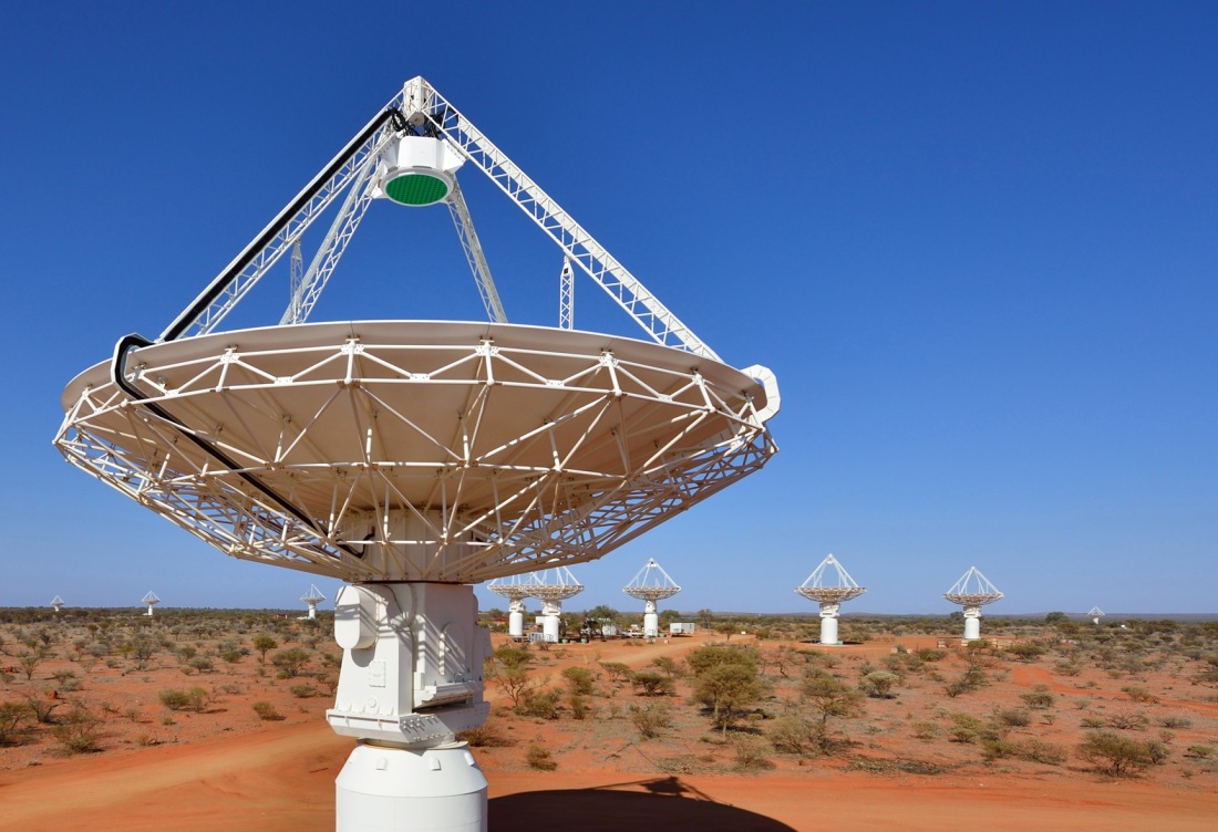


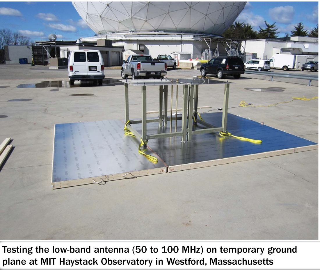
 Haystack Observatory EDGES telescope in a radio quiet zone at the Inyarrimanha Ilgari Bundara Murchison Radio-astronomy Observatory (MRO), on the traditional lands of the Wajarri peoples.


