
January 16, 2019
Jason Patton, Ph.D.
Ross Stein, Ph.D., Volkan Sevilgen, M.Sc.
Twenty-five years ago, the M=6.7 Northridge earthquake caused enormous damage in southern California. Today people are far less insured, and the best estimates suggest that we would take a major economic hit if one like it were to strike the Southland today. The government shutdown would only compound the problems.
What if the Northridge Earthquake Happened Today?
The M=6.7 earthquake struck on a ‘blind’ thrust fault (meaning that geologists were blind to its presence). There are other blind faults in southern California that pose an equal or greater hazard to the economy and well-being of Angelinos, and despite being associated with earthquakes up to M=7.3, blind thrusts are notoriously difficult to identify. Learn more about these faults here.

Sylmar Overpass damage from the 1994 Northridge earthquake. Credit: USGS Public Domain
Dr. Patricia Grossi from RMS, Inc., concluded that if an M=6.7 Northridge earthquake struck in 2014, it would cause up to $155 billion in total economic losses, comparable to that for Hurricane Katrina, which cost the nation $148 billion. But the insured losses would amount to only $16-$24 billion, or 10-15% of the total.
What about other quakes in the Southland?
An earthquake on the Puente Hills blind thrust fault, which runs beneath much of the Los Angeles basin including downtown, could cause over $600 billion in economic damages (Larsen et al., 2015). A recent M=5.1 earthquake on 29 March 2014 highlighted the presence of the Puente Hills and other blind fault faults in southern California capable of producing damaging earthquakes.
The 1933 M=6.4 Long Beach earthquake ruptured the Newport-Inglewood fault, killing 120 and causing widespread damage estimated to be between $40 and $50 million (1933 dollars; Swift et al., 2012). If the 1993 Long Beach earthquake were to recur, the losses could be between $131 and $781 million, depending upon the earthquake size (given analysis in 2006 using valuation estimates from 2002; Swift et al., 2012).
Many are familiar with the hazards from an earthquake on the San Andreas fault. If not, check out the video series “The Whistle.” The U.S. Geological Survey prepared a study of the impacts of an earthquake on the southern San Andreas fault (Jones et al., 2008). Using a computer tool developed by FEMA, they estimate that there may be as many as 1800 deaths and $191 billion in damages (in 2008 dollars and level of infrastructural development; Porter et al., 2011).

A large earthquake on the Puente Hills Blind Thrust Fault would strongly shake the most densely part of the Southland. The color gradients give the size of an earthquake expected over the period of a human lifetime (Bird et al., 2013). So for greater Los Angeles, a M=6.5-7.0 is likely.
Do you know what your losses to earthquake hazards would be? Check Your Risk in the Temblor app here.
Below is a map showing historic earthquakes in southern California (Hauksson et al., 1995). The spatial extent of the aftershocks correlate roughly with damage.

Historic earthquakes in southern California (Hauksson et al., 1995).
The partial shutdown could make things worse
During the government shutdown, the USGS is operating with a skeletal crew just sufficient to monitor earthquakes in California and around the world. However, no routine maintenance of its seismic and geodetic stations is being conducted, no buildout of the partially-completed Earthquake Early Warning system is being undertaken, no research is conducted, no publications are produced, no research meetings are held, and there is a press blackout.
In the event of a large California earthquake, the USGS has been granted authority by the Department of Interior to resume operations with as large a staff as needed to protect life and property, and to collect essential data.
Forrest Lanning, Earthquake Program Manager for FEMA Region IX (southwest U.S.), explained that if there were a disaster, FEMA would be mobilized in accordance with their mandate to respond to requests of disaster declaration from the state. Mobilized FEMA personnel would be given authorization to be paid for overtime under the Stafford Act, but the work leading up to this overtime would not be covered unless congress provided authorization. The FEMA Watch Center is required to be in operation 24 hours a day, 7 days a week. Staff at the watch center keep their eyes on media and other sources to determine if events may impact Region IX. They work with the NOAA Pacific Tsunami Warning Center and the USGS to monitor these potential impacts.
But what would happen if, instead, there were a swarm of small earthquakes on a major fault, as occurred at the southern tip of the San Andreas in September 2016, or near the Calaveras Fault in northern California in February 2018? In fact, today, there was a M=3.4 quake followed by several others on the Hayward Fault, which last ruptured in a M~7 shock in 1868. Because of widespread damage, the 1868 quake was known as the ‘Great San Francisco Quake’ until it was dethroned in 1906.

When a swarm culminating in a M=4.3 shock occurred in September 2016 at Bombay Beach near the southern end of the San Andreas, USGS calculations and consultations led the California Office of Emergency Services to issue a week-long ‘Earthquake Advisory’ for the entire Southland.
Seismic swarms are simply unchartered shutdown territory.
Rate of Insurance Coverage is Down
In 1994, 34% of Californians carried earthquake insurance. Today this is down to about 10%. Why is this?
Costs are up
The Northridge quake caused about $40 billion in damage in 1994 dollars (Eguchi et al., 1998), which was an unprecedented loss to the insurance industry, leading to a complicated response, with many insurers refusing to offer homeowner’s policies if they had to offer quake.
The California Earthquake Authority was set up by the state following Northridge, to help provide insurance when most carriers refused to do so. The CEA is a privately funded, but publicly managed, provider of residential earthquake insurance. But because of a reassessment of the risk, all earthquake insurance premiums, as well as deductibles, rose.
Out of sight, out of mind
The more time passes following an event, the more rapidly people stop considering the potential impact of such an event if it were to recur in the future. This is especially true for earthquakes.
In 1989, the large Loma Prieta earthquake devastated the San Francisco Bay area. The entire country responded in this time of need and the visual evidence of the impact of this quake was broadcast globally. People were aware of their place in earthquake country and this may have contributed to the large proportion of people who had earthquake insurance when the Northridge quake hit.
So, the take away from this is that, depending on the costs of repairing expected quake damage to your home, you should consider earthquake insurance and seismic retrofit. Without economic resilience, we may crumble under the load, as the column did in the following photo.

Building damage from 1994 Northridge earthquake, the parking structure at CSU Northridge. Credit: USGS public domain.
References
Bird, P., Jackson, D. D., Kagan, Y. Y., Kreemer, C., and Stein, R. S., 2015. GEAR1: A global earthquake activity rate model constructed from geodetic strain rates and smoothed seismicity, Bull. Seismol. Soc. Am., v. 105, no. 5, p. 2538–2554, DOI: 10.1785/0120150058
Eguchi, R.T., Goltz, J.D., Taylor, C.E., Chang, S.E., Flores, P.J., Johnson, L.A., Seligson, H.A., and Blais, N.C., 1998. Direct Economic Losses in the Northridge Earthquake: A Three-Year Post-Event Perspective in Earthquake Spectra, v. 14, no. 2, p. 245-264 DOI: 10.1193/1.1585998
Grossi, Patricia (2014), Northridge Earthquake today could cost insurers $20B, Carrier Management, 20 January 2014, https://www.carriermanagement.com/news/2014/01/20/117897.htm
Hauksson, E., Jones, L.M., and Hutton, K., 1995. The 1994 Northridge earthquake sequence in California: Seismological and tectonic aspects in Journal of Geophysical Research, v., 100, no. B7, p. 12235-12355.
Jones, L.M., Bernknopf, R., Cox, D., Goltz, J., Hudnut, K., Mileti, D., Perry, S., Ponti, D., Porter, K., Reichle, M., Seligson, H., Shoaf, K., Teriman, J., and Wein, A., 2008. The Shakeout Scenario, USGS Open File Report 2008-1150, CGS Preliminary Report 25, Version 1.0.
Larsen, T., Bolton, M.K., and David, K.M., 2015. Pinpointing the Cost of Natural Disasters – Local Devastation and Global Impact in proceedings SECED 2015 Conference: Earthquake Risk and Engineering towards a Resilient World 9-10 July 2015, Cambridge UK, 11 pp.
Porter, K., Jones, L., Cox, D., Goltz, J., Hudnut, K., Mileti, D., Perry, S., Ponti, D., Reichle, M., Rose, A.Z. Scawthorn, C., Seligson, H.A., Shoaf, K.I., Treiman, J., and Wein, A., 2011. The ShakeOut Scenario: A Hypothetical Mw7.8 Earthquake on the Southern San Andreas Fault in Earthquake Spectra, v. 27, no. 2., p 239-261, DOI: 10.1193/1.3563624
Swift, J., Wilson, J., and Le, T.N., 2012. Estimated Temporal Variation of Losses Due to a Recurrence of the 1933 Long Beach Earthquake in Earthquake Spectra, v. 28, no. 1, p. 347-365 DOI: 10.1193/1.3672995
Read about the earthquake that killed insurance at the Jumpstart Blog here.
Learn more about the tectonics behind the 17 January 1994 M=6.7 Northridge earthquake here.
See the full article here .

five-ways-keep-your-child-safe-school-shootings
Please help promote STEM in your local schools.
![]()
Stem Education Coalition
![]()
![]()
Earthquake Network project
Earthquake Network is a research project which aims at developing and maintaining a crowdsourced smartphone-based earthquake warning system at a global level. Smartphones made available by the population are used to detect the earthquake waves using the on-board accelerometers. When an earthquake is detected, an earthquake warning is issued in order to alert the population not yet reached by the damaging waves of the earthquake.
The project started on January 1, 2013 with the release of the homonymous Android application Earthquake Network. The author of the research project and developer of the smartphone application is Francesco Finazzi of the University of Bergamo, Italy.
Get the app in the Google Play store.
Smartphone network spatial distribution (green and red dots) on December 4, 2015
Meet The Quake-Catcher Network

The Quake-Catcher Network is a collaborative initiative for developing the world’s largest, low-cost strong-motion seismic network by utilizing sensors in and attached to internet-connected computers. With your help, the Quake-Catcher Network can provide better understanding of earthquakes, give early warning to schools, emergency response systems, and others. The Quake-Catcher Network also provides educational software designed to help teach about earthquakes and earthquake hazards.
After almost eight years at Stanford, and a year at CalTech, the QCN project is moving to the University of Southern California Dept. of Earth Sciences. QCN will be sponsored by the Incorporated Research Institutions for Seismology (IRIS) and the Southern California Earthquake Center (SCEC).
The Quake-Catcher Network is a distributed computing network that links volunteer hosted computers into a real-time motion sensing network. QCN is one of many scientific computing projects that runs on the world-renowned distributed computing platform Berkeley Open Infrastructure for Network Computing (BOINC).
The volunteer computers monitor vibrational sensors called MEMS accelerometers, and digitally transmit “triggers” to QCN’s servers whenever strong new motions are observed. QCN’s servers sift through these signals, and determine which ones represent earthquakes, and which ones represent cultural noise (like doors slamming, or trucks driving by).
There are two categories of sensors used by QCN: 1) internal mobile device sensors, and 2) external USB sensors.
Mobile Devices: MEMS sensors are often included in laptops, games, cell phones, and other electronic devices for hardware protection, navigation, and game control. When these devices are still and connected to QCN, QCN software monitors the internal accelerometer for strong new shaking. Unfortunately, these devices are rarely secured to the floor, so they may bounce around when a large earthquake occurs. While this is less than ideal for characterizing the regional ground shaking, many such sensors can still provide useful information about earthquake locations and magnitudes.
USB Sensors: MEMS sensors can be mounted to the floor and connected to a desktop computer via a USB cable. These sensors have several advantages over mobile device sensors. 1) By mounting them to the floor, they measure more reliable shaking than mobile devices. 2) These sensors typically have lower noise and better resolution of 3D motion. 3) Desktops are often left on and do not move. 4) The USB sensor is physically removed from the game, phone, or laptop, so human interaction with the device doesn’t reduce the sensors’ performance. 5) USB sensors can be aligned to North, so we know what direction the horizontal “X” and “Y” axes correspond to.
If you are a science teacher at a K-12 school, please apply for a free USB sensor and accompanying QCN software. QCN has been able to purchase sensors to donate to schools in need. If you are interested in donating to the program or requesting a sensor, click here.
BOINC is a leader in the field(s) of Distributed Computing, Grid Computing and Citizen Cyberscience.BOINC is more properly the Berkeley Open Infrastructure for Network Computing, developed at UC Berkeley.
Earthquake safety is a responsibility shared by billions worldwide. The Quake-Catcher Network (QCN) provides software so that individuals can join together to improve earthquake monitoring, earthquake awareness, and the science of earthquakes. The Quake-Catcher Network (QCN) links existing networked laptops and desktops in hopes to form the worlds largest strong-motion seismic network.
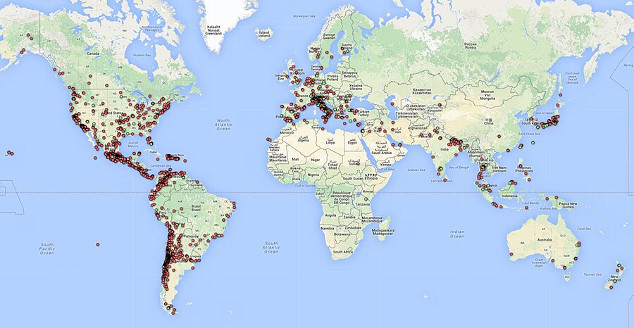
Below, the QCN Quake Catcher Network map

ShakeAlert: An Earthquake Early Warning System for the West Coast of the United States

The U. S. Geological Survey (USGS) along with a coalition of State and university partners is developing and testing an earthquake early warning (EEW) system called ShakeAlert for the west coast of the United States. Long term funding must be secured before the system can begin sending general public notifications, however, some limited pilot projects are active and more are being developed. The USGS has set the goal of beginning limited public notifications in 2018.
Watch a video describing how ShakeAlert works in English or Spanish.
The primary project partners include:
United States Geological Survey
California Governor’s Office of Emergency Services (CalOES)
California Geological Survey
California Institute of Technology
University of California Berkeley
University of Washington
University of Oregon
Gordon and Betty Moore Foundation
The Earthquake Threat
Earthquakes pose a national challenge because more than 143 million Americans live in areas of significant seismic risk across 39 states. Most of our Nation’s earthquake risk is concentrated on the West Coast of the United States. The Federal Emergency Management Agency (FEMA) has estimated the average annualized loss from earthquakes, nationwide, to be $5.3 billion, with 77 percent of that figure ($4.1 billion) coming from California, Washington, and Oregon, and 66 percent ($3.5 billion) from California alone. In the next 30 years, California has a 99.7 percent chance of a magnitude 6.7 or larger earthquake and the Pacific Northwest has a 10 percent chance of a magnitude 8 to 9 megathrust earthquake on the Cascadia subduction zone.
Part of the Solution
Today, the technology exists to detect earthquakes, so quickly, that an alert can reach some areas before strong shaking arrives. The purpose of the ShakeAlert system is to identify and characterize an earthquake a few seconds after it begins, calculate the likely intensity of ground shaking that will result, and deliver warnings to people and infrastructure in harm’s way. This can be done by detecting the first energy to radiate from an earthquake, the P-wave energy, which rarely causes damage. Using P-wave information, we first estimate the location and the magnitude of the earthquake. Then, the anticipated ground shaking across the region to be affected is estimated and a warning is provided to local populations. The method can provide warning before the S-wave arrives, bringing the strong shaking that usually causes most of the damage.
Studies of earthquake early warning methods in California have shown that the warning time would range from a few seconds to a few tens of seconds. ShakeAlert can give enough time to slow trains and taxiing planes, to prevent cars from entering bridges and tunnels, to move away from dangerous machines or chemicals in work environments and to take cover under a desk, or to automatically shut down and isolate industrial systems. Taking such actions before shaking starts can reduce damage and casualties during an earthquake. It can also prevent cascading failures in the aftermath of an event. For example, isolating utilities before shaking starts can reduce the number of fire initiations.
System Goal
The USGS will issue public warnings of potentially damaging earthquakes and provide warning parameter data to government agencies and private users on a region-by-region basis, as soon as the ShakeAlert system, its products, and its parametric data meet minimum quality and reliability standards in those geographic regions. The USGS has set the goal of beginning limited public notifications in 2018. Product availability will expand geographically via ANSS regional seismic networks, such that ShakeAlert products and warnings become available for all regions with dense seismic instrumentation.
Current Status
The West Coast ShakeAlert system is being developed by expanding and upgrading the infrastructure of regional seismic networks that are part of the Advanced National Seismic System (ANSS); the California Integrated Seismic Network (CISN) is made up of the Southern California Seismic Network, SCSN) and the Northern California Seismic System, NCSS and the Pacific Northwest Seismic Network (PNSN). This enables the USGS and ANSS to leverage their substantial investment in sensor networks, data telemetry systems, data processing centers, and software for earthquake monitoring activities residing in these network centers. The ShakeAlert system has been sending live alerts to “beta” users in California since January of 2012 and in the Pacific Northwest since February of 2015.
In February of 2016 the USGS, along with its partners, rolled-out the next-generation ShakeAlert early warning test system in California joined by Oregon and Washington in April 2017. This West Coast-wide “production prototype” has been designed for redundant, reliable operations. The system includes geographically distributed servers, and allows for automatic fail-over if connection is lost.
This next-generation system will not yet support public warnings but does allow selected early adopters to develop and deploy pilot implementations that take protective actions triggered by the ShakeAlert notifications in areas with sufficient sensor coverage.
Authorities
The USGS will develop and operate the ShakeAlert system, and issue public notifications under collaborative authorities with FEMA, as part of the National Earthquake Hazard Reduction Program, as enacted by the Earthquake Hazards Reduction Act of 1977, 42 U.S.C. §§ 7704 SEC. 2.
For More Information
Robert de Groot, ShakeAlert National Coordinator for Communication, Education, and Outreach
rdegroot@usgs.gov
626-583-7225
