![]()
5.16.23 [Just today in social media.]
Marcus Wolf
207.581.3721
marcus.wolf@maine.edu
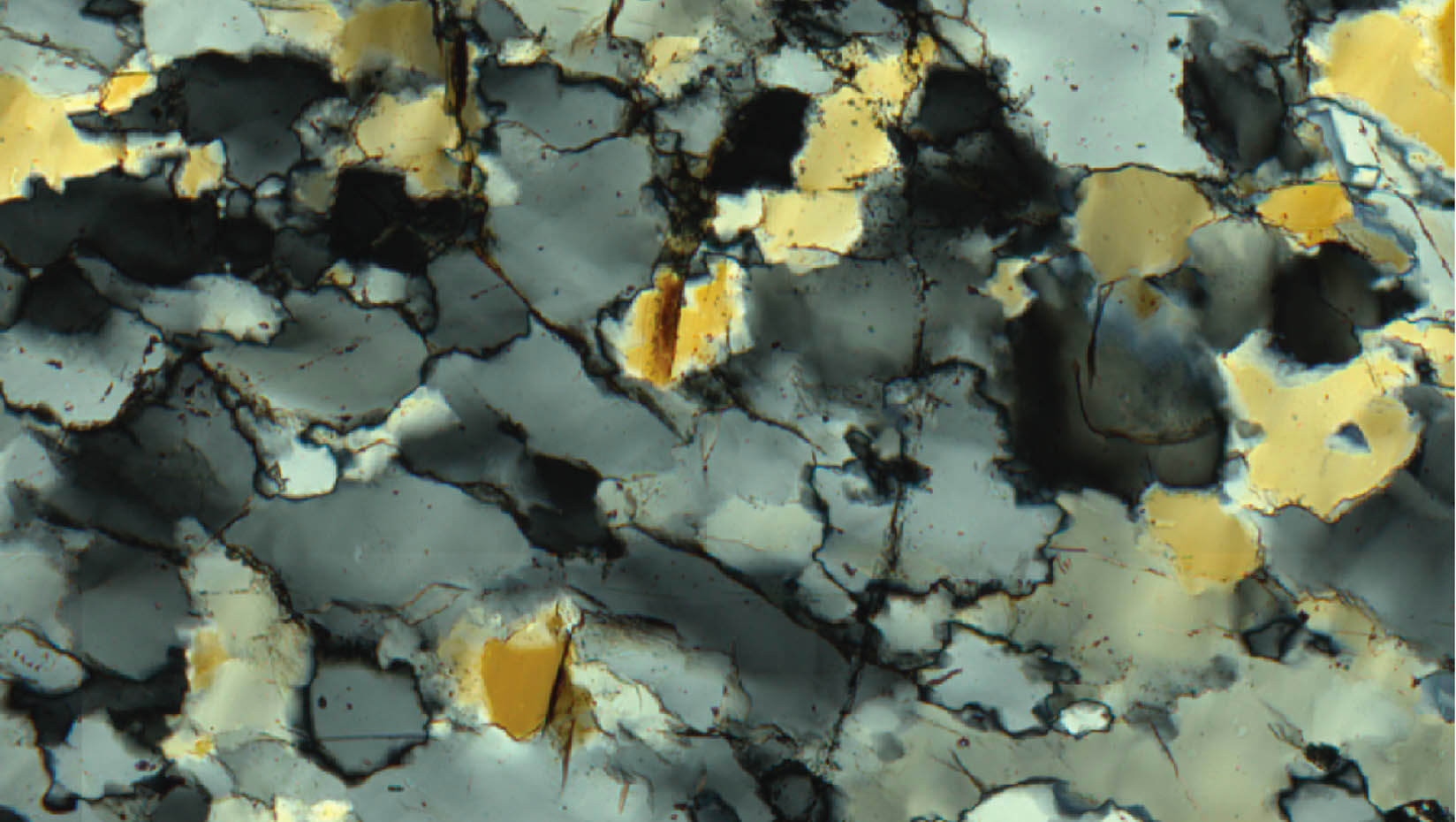
An image of quartz grain seen through an optical microscope using cross polarized light. Credit: Erik Anderson.
Creating new, more accurate methods for quantifying the stress and flow rate experienced by deforming rocks at the boundaries of moving tectonic plates is the goal of a University of Maine study funded with a $392,372 National Science Foundation grant.

Scott Johnson, a professor of structural geology, and Senthil Vel, a professor of mechanical engineering, will develop these new calculations in collaboration with a postdoctoral researcher, a Ph.D. student and up to three undergraduates from the School of Earth and Climate Sciences or Department of Mechanical Engineering. They also will work with Greg Hirth, a professor at Brown University in Rhode Island, and David Prior, a professor at Otago University in New Zealand.
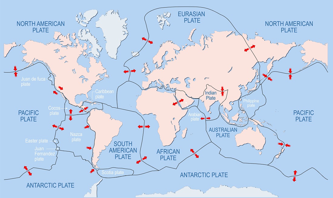
The stress on rocks from tectonic plate movement causes them to flow, and this flow is what causes mountains to grow and also triggers earthquakes. More insight into these stresses and related flow leads to a better understanding of fundamental plate tectonic processes, and can inform decision making in construction, infrastructure maintenance and emergency preparedness.
A common method for relating the stress and flow rate involves mathematical equations known as flow laws. These equations are derived through laboratory deformation experiments and are associated with specific microstructural characteristics such as mineral shape and size. For example, through these experiments, it has been shown that the average size of a mineral such as quartz that recrystallizes during deformation is directly proportional to the applied stress.
While these existing flow laws are effective, they involve significant uncertainties related to estimates of average recrystallized grain size and the activation energy associated with the flow process, and there are currently no other methods available with which to compare results. UMaine researchers aim to develop a new method based on the roughness of mineral grain boundaries and explore how they can record stress and flow rates.
This new method is based on the principle that the roughness of a grain boundary reflects the competition between elastic energy stored as defects in the crystal structure and surface energy stored at the grain boundary. The rougher the grain boundary, the more surface energy is being stored. According to researchers, this roughness is proportional to both applied stress and flow rate through a fractal dimension.
“Fractal roughness is used extensively in the physical, natural and social sciences to evaluate properties as diverse as material strength, cloud formation and urban sprawl,” Johnson says. “The specific technique we are employing was proposed in the 1990s, but has not been further developed until now. Our preliminary data are exciting and we anticipate it will open up new avenues of research in material and Earth science that will benefit scientists, engineers and the general public.”
The research has two main components focusing on laboratory deformation experiments and field-based measurements. The laboratory experiments involve the deformation of polycrystalline quartz samples under tightly controlled conditions of temperature, applied stress and resulting flow rate. The fractal dimension values measured in these deformed samples will be used to calibrate researchers’ new method. Simultaneously, fractal dimension values will be determined in deformed polycrystalline quartz aggregates from the Sandhill Corner shear zone, located in Somerville, Maine. The shear zone is part of the Norumbega fault system, which lies along the southern half of Maine and spans from its western border to the western edge of New Brunswick, Canada.
As part of this work, new protocols are being developed for automated measurement of grain perimeters using electron backscatter diffraction techniques using the scanning electron microscope in the School of Earth and Climate Sciences.
Applying their new, experimentally calibrated method to the Sandhill Corner rocks will allow researchers to compare results with those from existing flow laws and hopefully provide an alternative method for evaluating stress and flow rate. In addition, the Norumbega fault system serves as an ancient analog for the currently active San Andreas fault system in California, so the results will have direct application to earthquake faults.
“This interdisciplinary project is the latest in a series of NSF projects involving faculty and students from Earth sciences and mechanical engineering to develop new computational techniques and codes that will help us understand the influence of microstructure on the macroscopic properties of heterogeneous material systems,” Vel says. “The outcomes are applicable beyond Earth Sciences and will allow materials scientists to engineer the strength of metals, ceramics and advanced composite materials.”
___________________________________________________________________
Earthquake Alert
![]()
![]()
Earthquake Network project smartphone ap is a research project which aims at developing and maintaining a crowdsourced smartphone-based earthquake warning system at a global level. Smartphones made available by the population are used to detect the earthquake waves using the on-board accelerometers. When an earthquake is detected, an earthquake warning is issued in order to alert the population not yet reached by the damaging waves of the earthquake.
The project started on January 1, 2013 with the release of the homonymous Android application Earthquake Network. The author of the research project and developer of the smartphone application is Francesco Finazzi of the University of Bergamo, Italy.
Get the app in the Google Play store.
Smartphone network spatial distribution (green and red dots) on December 4, 2015
QuakeAlertUSA
About Early Warning Labs, LLC
Early Warning Labs, LLC (EWL) is an Earthquake Early Warning technology developer and integrator located in Santa Monica, CA. EWL is partnered with industry leading GIS provider ESRI, Inc. and is collaborating with the US Government and university partners.
EWL is investing millions of dollars over the next 36 months to complete the final integration and delivery of Earthquake Early Warning to individual consumers, government entities, and commercial users.
EWL’s mission is to improve, expand, and lower the costs of the existing earthquake early warning systems.
EWL is developing a robust cloud server environment to handle low-cost mass distribution of these warnings. In addition, Early Warning Labs is researching and developing automated response standards
and systems that allow public and private users to take pre-defined automated actions to protect lives and assets.
EWL has an existing beta R&D test system installed at one of the largest studios in Southern California. The goal of this system is to stress test EWL’s hardware, software, and alert signals while improving latency and reliability.
ShakeAlert: An Earthquake Early Warning System for the West Coast of the United States

The U. S. Geological Survey (USGS) along with a coalition of State and university partners is developing and testing an earthquake early warning (EEW) system called ShakeAlert for the west coast of the United States. Long term funding must be secured before the system can begin sending general public notifications, however, some limited pilot projects are active and more are being developed. The USGS has set the goal of beginning limited public notifications in 2018.
Watch a video describing how ShakeAlert works in English or Spanish.
The primary project partners include:
United States Geological Survey
California Governor’s Office of Emergency Services (CalOES)
California Geological Survey California Institute of Technology
University of California Berkeley
University of Washington
University of Oregon
Gordon and Betty Moore Foundation
The Earthquake Threat
Earthquakes pose a national challenge because more than 143 million Americans live in areas of significant seismic risk across 39 states. Most of our Nation’s earthquake risk is concentrated on the West Coast of the United States. The Federal Emergency Management Agency (FEMA) has estimated the average annualized loss from earthquakes, nationwide, to be $5.3 billion, with 77 percent of that figure ($4.1 billion) coming from California, Washington, and Oregon, and 66 percent ($3.5 billion) from California alone. In the next 30 years, California has a 99.7 percent chance of a magnitude 6.7 or larger earthquake and the Pacific Northwest has a 10 percent chance of a magnitude 8 to 9 megathrust earthquake on the Cascadia subduction zone.
Part of the Solution
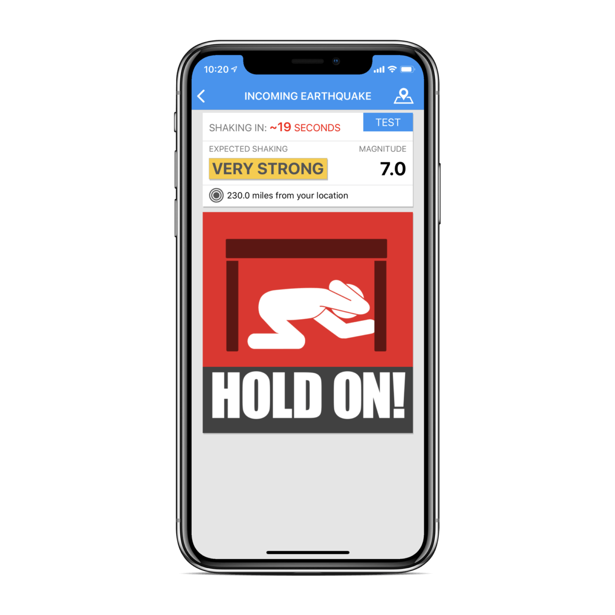
Today, the technology exists to detect earthquakes, so quickly, that an alert can reach some areas before strong shaking arrives. The purpose of the ShakeAlert system is to identify and characterize an earthquake a few seconds after it begins, calculate the likely intensity of ground shaking that will result, and deliver warnings to people and infrastructure in harm’s way. This can be done by detecting the first energy to radiate from an earthquake, the P-wave energy, which rarely causes damage. Using P-wave information, we first estimate the location and the magnitude of the earthquake. Then, the anticipated ground shaking across the region to be affected is estimated and a warning is provided to local populations. The method can provide warning before the S-wave arrives, bringing the strong shaking that usually causes most of the damage.
Studies of earthquake early warning methods in California have shown that the warning time would range from a few seconds to a few tens of seconds. ShakeAlert can give enough time to slow trains and taxiing planes, to prevent cars from entering bridges and tunnels, to move away from dangerous machines or chemicals in work environments and to take cover under a desk, or to automatically shut down and isolate industrial systems. Taking such actions before shaking starts can reduce damage and casualties during an earthquake. It can also prevent cascading failures in the aftermath of an event. For example, isolating utilities before shaking starts can reduce the number of fire initiations.
System Goal
The USGS will issue public warnings of potentially damaging earthquakes and provide warning parameter data to government agencies and private users on a region-by-region basis, as soon as the ShakeAlert system, its products, and its parametric data meet minimum quality and reliability standards in those geographic regions. The USGS has set the goal of beginning limited public notifications in 2018. Product availability will expand geographically via ANSS regional seismic networks, such that ShakeAlert products and warnings become available for all regions with dense seismic instrumentation.
Current Status
The West Coast ShakeAlert system is being developed by expanding and upgrading the infrastructure of regional seismic networks that are part of the Advanced National Seismic System (ANSS); the California Integrated Seismic Network (CISN) is made up of the Southern California Seismic Network, SCSN) and the Northern California Seismic System, NCSS and the Pacific Northwest Seismic Network (PNSN). This enables the USGS and ANSS to leverage their substantial investment in sensor networks, data telemetry systems, data processing centers, and software for earthquake monitoring activities residing in these network centers. The ShakeAlert system has been sending live alerts to “beta” users in California since January of 2012 and in the Pacific Northwest since February of 2015.
In February of 2016 the USGS, along with its partners, rolled-out the next-generation ShakeAlert early warning test system in California joined by Oregon and Washington in April 2017. This West Coast-wide “production prototype” has been designed for redundant, reliable operations. The system includes geographically distributed servers, and allows for automatic fail-over if connection is lost.
This next-generation system will not yet support public warnings but does allow selected early adopters to develop and deploy pilot implementations that take protective actions triggered by the ShakeAlert notifications in areas with sufficient sensor coverage.
Authorities
The USGS will develop and operate the ShakeAlert system, and issue public notifications under collaborative authorities with FEMA, as part of the National Earthquake Hazard Reduction Program, as enacted by the Earthquake Hazards Reduction Act of 1977, 42 U.S.C. §§ 7704 SEC. 2.
For More Information
Robert de Groot, ShakeAlert National Coordinator for Communication, Education, and Outreach
rdegroot@usgs.gov
626-583-7225
ShakeAlert Implementation Plan
Earthquake Early Warning Introduction
The United States Geological Survey (USGS), in collaboration with state agencies, university partners, and private industry, is developing an earthquake early warning system (EEW) for the West Coast of the United States called ShakeAlert. The USGS Earthquake Hazards Program aims to mitigate earthquake losses in the United States. Citizens, first responders, and engineers rely on the USGS for accurate and timely information about where earthquakes occur, the ground shaking intensity in different locations, and the likelihood is of future significant ground shaking.
The ShakeAlert Earthquake Early Warning System recently entered its first phase of operations. The USGS working in partnership with the California Governor’s Office of Emergency Services (Cal OES) is now allowing for the testing of public alerting via apps, Wireless Emergency Alerts, and by other means throughout California.
ShakeAlert partners in Oregon and Washington are working with the USGS to test public alerting in those states sometime in 2020.
ShakeAlert has demonstrated the feasibility of earthquake early warning, from event detection to producing USGS issued ShakeAlerts ® and will continue to undergo testing and will improve over time. In particular, robust and reliable alert delivery pathways for automated actions are currently being developed and implemented by private industry partners for use in California, Oregon, and Washington.
Earthquake Early Warning Background
The objective of an earthquake early warning system is to rapidly detect the initiation of an earthquake, estimate the level of ground shaking intensity to be expected, and issue a warning before significant ground shaking starts. A network of seismic sensors detects the first energy to radiate from an earthquake, the P-wave energy, and the location and the magnitude of the earthquake is rapidly determined. Then, the anticipated ground shaking across the region to be affected is estimated. The system can provide warning before the S-wave arrives, which brings the strong shaking that usually causes most of the damage. Warnings will be distributed to local and state public emergency response officials, critical infrastructure, private businesses, and the public. EEW systems have been successfully implemented in Japan, Taiwan, Mexico, and other nations with varying degrees of sophistication and coverage.
Earthquake early warning can provide enough time to:
Instruct students and employees to take a protective action such as Drop, Cover, and Hold On
Initiate mass notification procedures
Open fire-house doors and notify local first responders
Slow and stop trains and taxiing planes
Install measures to prevent/limit additional cars from going on bridges, entering tunnels, and being on freeway overpasses before the shaking starts
Move people away from dangerous machines or chemicals in work environments
Shut down gas lines, water treatment plants, or nuclear reactors
Automatically shut down and isolate industrial systems
However, earthquake warning notifications must be transmitted without requiring human review and response action must be automated, as the total warning times are short depending on geographic distance and varying soil densities from the epicenter.
GNSS-Global Navigational Satellite System
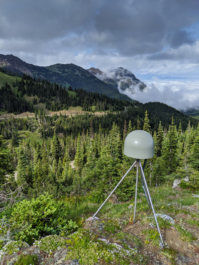
GNSS station | Pacific Northwest Geodetic Array, Central Washington University (US)
How Android Earthquake Alerts System Works
Earthquakes happen daily around the world, with hundreds of millions of people living in earthquake prone regions. An early warning can help people prepare for shaking, but the public infrastructure to detect and alert everyone for an earthquake is costly to build and deploy. We saw an opportunity to use Android to provide people with timely, helpful earthquake information when they use Google search, and a few seconds warning to get themselves and their loved ones to safety if needed.
Android Earthquake Alerts System is a free service that detects earthquakes around the world and can alert Android users before shaking starts.
Detecting an Earthquake
In California, Washington, and Oregon, we partner with the ShakeAlert® team to distribute alerts provided by their system. ShakeAlert uses a network of 1675 seismic sensors to detect earthquake shaking, and analyzes that data to determine the location and size of the earthquake. The ShakeAlert® system then sends a signal to Android Earthquake Alerts System, which then sends an earthquake alert directly to Android users.
Outside of these U.S. states, we use a crowdsourced approach to detect earthquakes. All smartphones contain tiny accelerometers that can sense vibrations and speed, signals that indicate an earthquake might be happening. If the phone detects something that it thinks may be an earthquake, it sends a signal to our earthquake detection server, along with a coarse location of where the shaking occurred. The server then combines information from many phones to figure out if an earthquake is happening. This approach uses the 2+billion Android phones in use around the world as mini-seismometers to create the world’s largest earthquake detection network; the phones detect the vibration and speed of shaking of an earthquake, and alert Android users in affected areas accordingly.
Alerting Users During an Earthquake
Android has two types of notifications designed to alert users about an earthquake. Both alert types are only sent for earthquakes of magnitude 4.5 or greater.

Be Aware Alert
[Weak / Light Shaking]

Take Action Alert
[Moderate / Extreme Shaking]
See the full article here.
Comments are invited and will be appreciated, especially if the reader finds any errors which I can correct. Use “Reply”.

five-ways-keep-your-child-safe-school-shootings
Please help promote STEM in your local schools.
![]()

The University of Maine is a public land-grant research university in Orono, Maine. It was established in 1865 as the land-grant college of Maine and is the flagship university of the University of Maine System. The University of Maine is one of only a few land, sea and space grant institutions in the nation. It is classified among “R2: Doctoral Universities – High research activity”.
With an enrollment of approximately 11,500 students, The University of Maine is the state’s largest college or university. The University of Maine’s athletic teams, nicknamed the Black Bears, are Maine’s only Division I athletics program. Maine’s men’s ice hockey team has won two national championships.
The University of Maine was founded in 1862 as a function of the Morrill Act, signed by President Abraham Lincoln. Established in 1865 as the Maine State College of Agriculture and the Mechanic Arts, the college opened on September 21, 1868 and changed its name to the University of Maine in 1897.
By 1871, curricula had been organized in Agriculture, Engineering, and electives. The Maine Agricultural and Forest Experiment Station was founded as a division of the university in 1887. Gradually the university developed the Colleges of Life Sciences and Agriculture (later to include the School of Forest Resources and the School of Human Development), Engineering and Science, and Arts and Sciences. In 1912 the Maine Cooperative Extension, which offers field educational programs for both adults and youths, was initiated. The School of Education was established in 1930 and received college status in 1958. The School of Business Administration was formed in 1958 and was granted college status in 1965. Women have been admitted into all curricula since 1872. The first master’s degree was conferred in 1881; the first doctor’s degree in 1960. Since 1923 there has been a separate graduate school.
Near the end of the 19th century, the university expanded its curriculum to place greater emphasis on liberal arts. As a result of this shift, faculty hired during the early 20th century included Caroline Colvin, chair of the history department and the nation’s first woman to head a major university department.
In 1906, The Senior Skull Honor Society was founded to “publicly recognize, formally reward, and continually promote outstanding leadership and scholarship, and exemplary citizenship within the University of Maine community.”
On April 16, 1925, 80 women met in Balentine Hall — faculty, alumnae, and undergraduate representatives — to plan a pledging of members to an inaugural honorary organization. This organization was called “The All Maine Women” because only those women closely connected with the University of Maine were elected as members. On April 22, 1925, the new members were inducted into the honor society.
When the University of Maine System was incorporated, in 1968, the school was renamed by the legislature over the objections of the faculty to the University of Maine at Orono. This was changed back to the University of Maine in 1986.
