From The Woods Hole Oceanographic Institution
6.27.24
ELISE HUGUS
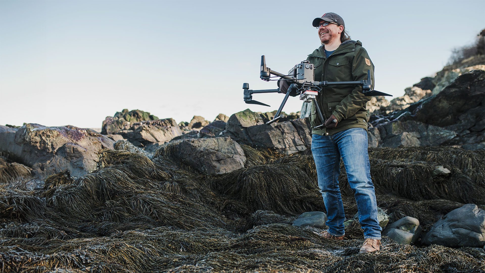
WHOI assistant scientist Tom Bell stands with his drone on a crop of rockweed in Nahant, Mass. (Photo by Daniel Hentz, © Woods Hole Oceanographic Institution)
The wind whipping off of Massachusetts Bay in mid-February is hardly daunted by the jagged, ice-encrusted rocks exposed along the low-tide shoreline. But Tom Bell is not deterred as he removes a quadcopter-style drone outfitted with an advanced imaging system from its black case. “It’s under 25 miles per hour, so we’re good to fly,” he remarks, sending the drone up and away over the intertidal zone.
In collaboration with his colleagues at Northeastern University, Bell, a WHOI scientist who specializes in coastal remote sensing, is surveying macroalgae known as rockweed or bladderwrack growing along the rocky coast north of Boston. Stitched together and viewed within specific electromagnetic bands back at the lab, the grayscale images reveal a world beyond the range of the human eye: a near-infrared blur of white that reveals chlorophyll, black shades that signify seaweed cover, and gray dots that are actually barnacles. This bird’s-eye view, combined with Northeastern’s field sampling and analysis, establishes a baseline of ecosystem health and changes on a scale that would be impossible to do with only feet and eyes on the ground.
“Since the ’70s, there’s been a huge decrease in the amount of mussels that used to be the primary space holders in this area along the Gulf of Maine. And some of that has been replaced by barnacles, but also a lot has been replaced by macroalgae,” Bell said. “I’m interested in how the system dynamics are changing, and how that’s affecting the intertidal community and carbon cycling in the coastal ocean. By drilling into the different electromagnetic bands, we can look at biomass, density, and even the physiological condition of various coastal foundation species.”
Whether it’s an algae-carpeted intertidal zone or a tropical mangrove, a waving seagrass meadow or a fecund salt marsh, plants and seaweed are the engines of coastal biodiversity—a green-tinged litmus of ecosystem health and “blue carbon” capacity. For many years, these wetlands were thought of as wastelands that were drained, filled, or removed. Or, they were simply overlooked as various pollutants washed into the ecosystem, drastically diminishing their storm-tempering, carbon-sequestering, and fish nursery benefits. As a result, an estimated 30% of the world’s seagrass meadows and mangroves have disappeared in the last century, and we continue to lose the equivalent of two soccer fields’ worth of salt marsh every hour. We know about the rate and scale of loss thanks to Landsat satellites, which have silently captured the decline from 438 miles (705 kilometers) above Earth for over 40 years.
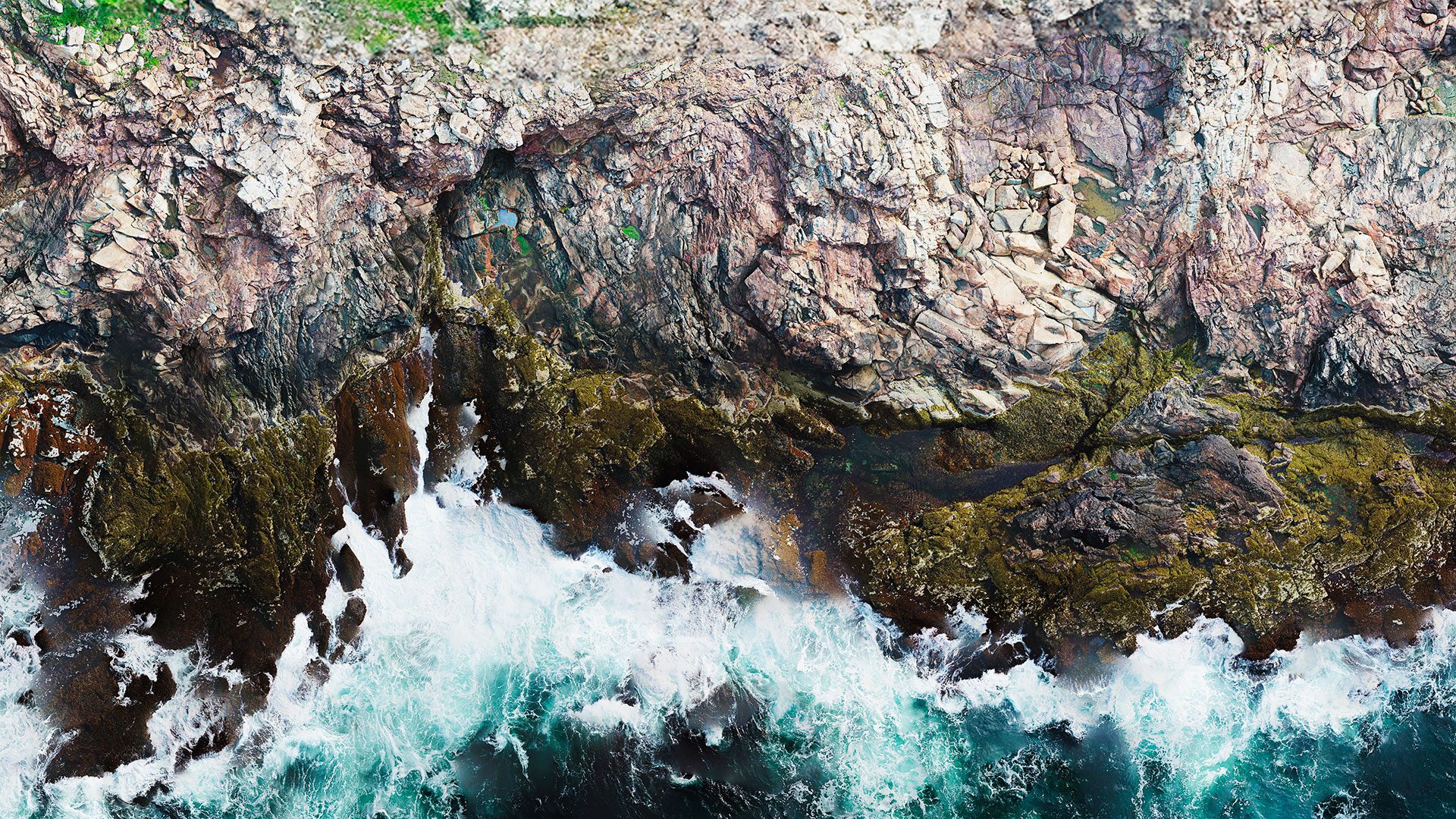
A high-resolution drone image of the coastline at Allen Island in Maine. (Photo courtesy of Tom Bell, © Woods Hole Oceanographic Institution)
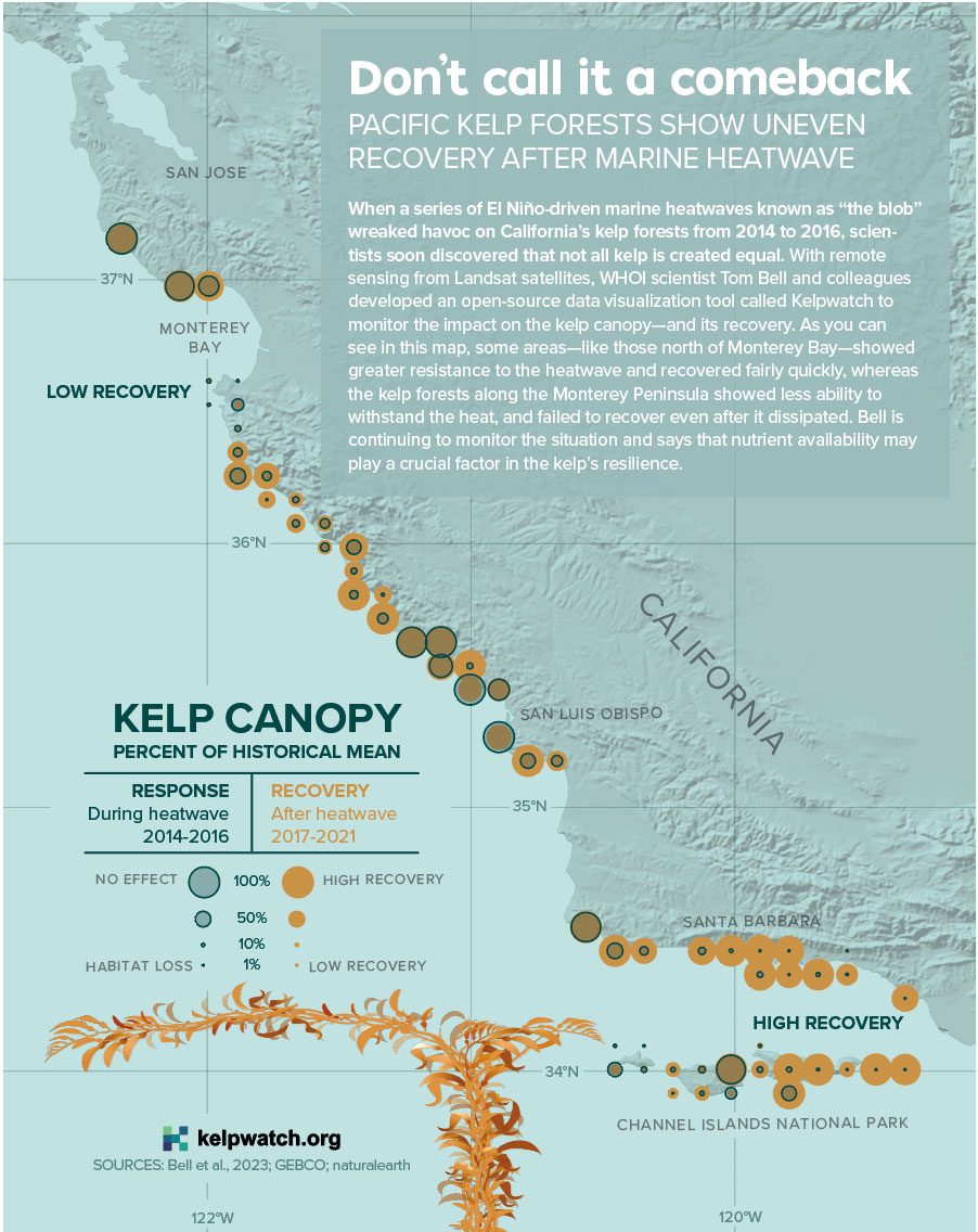
As a researcher at the University of California, Santa Barbara, Bell started wondering if he could use remote sensing with satellites to track the health of the West Coast’s prodigious kelp forests, which form canopies at the ocean surface. In partnership with researchers from NASA, the Nature Conservancy, and several academic institutions, Bell documented a 95% decline in bull kelp along 200 miles (322 kilometers) of the Northern California coast during the winter of 2014-2015, which the researchers attribute to a massive marine heatwave.
“My goal is to answer fundamental questions about how ecosystems work in general,” Bell said. “In the process, we’re creating toolboxes for people to have the opportunity to understand how systems are changing, and that can help with their conservation or restoration initiatives.”
In 2021, shortly after coming to WHOI, Bell and his partners launched an open-source website called Kelpwatch.org, which allows users to visualize changes in kelp canopy dynamics over time via a simple user interface. Three years into the project, they have expanded coverage from the U.S. West Coast to southern Alaska, Argentina, and the Falkland Islands, and they have plans to bring Chile, Tasmania, New Zealand, South Africa, and the sub-Antarctic islands on board soon. It’s a high-touch process: Ashland Aguilar, a research assistant in Bell’s lab, cross-references the initial results with high-resolution imagery from Google Earth before working with local researchers to review them.
Kelpwatch, according to Bell, offers a reliable and efficient way to scale up monitoring of critical coastal ecosystems. But he isn’t completely satisfied with the 30-meter (98-foot) resolution provided by satellites. To get a more detailed picture, he started using aerial drones equipped with hyperspectral (more than 50 bands), multispectral (10 bands), and even regular old color (three bands) cameras to survey the coast. The resulting data helps him create a “digital twin” to test the effects of waves, tides, and sunlight on the growth patterns of intertidal species.
He has applied this imaging technique from the rocky coast of Massachusetts to South Africa, where his lab joined the first BioSCape field campaign in the Greater Cape Floristic Region with NASA and international collaborators in the fall of 2023. The confluence of Atlantic and Indian Ocean currents stirs up a potent cocktail of nutrients that sustain lush kelp forests in this biodiversity hotspot on the Cape of Good Hope. NASA airplanes outfitted with advanced imaging sensors were instrumental in surveying the canopy, adding to the data gathered by Bell’s team with drones and field sampling to show the bigger picture of how changing ocean conditions, phytoplankton diversity, and harmful algal blooms impact the kelp forest.
“Remote sensing with satellites and planes will never replace field work,” said Bell. “But having a 700-kilometer (434-mile) view of Earth gives you a view of spatial patterns and connections you would never see otherwise.”
The research in this article was funded by Northeastern University and a WHOI seed grant (Nahant, MA), NASA Ocean Biology and Biogeochemistry (Global Kelp Map & BioSCape), NASA Biodiversity and Ecological Conservation (BioSCape), and The Nature Conservancy (Kelpwatch.org).
See the full article here.
Comments are invited and will be appreciated, especially if the reader finds any errors which I can correct.

five-ways-keep-your-child-safe-school-shootings
Please help promote STEM in your local schools.
![]()

Mission Statement
The Woods Hole Oceanographic Institution is dedicated to advancing knowledge of the ocean and its connection with the Earth system through a sustained commitment to excellence in science, engineering, and education, and to the application of this knowledge to problems facing society.
Vision & Mission
The ocean is a defining feature of our planet and crucial to life on Earth, yet it remains one of the planet’s last unexplored frontiers. For this reason, WHOI scientists and engineers are committed to understanding all facets of the ocean as well as its complex connections with Earth’s atmosphere, land, ice, seafloor, and life—including humanity. This is essential not only to advance knowledge about our planet, but also to ensure society’s long-term welfare and to help guide human stewardship of the environment. WHOI researchers are also dedicated to training future generations of ocean science leaders, to providing unbiased information that informs public policy and decision-making, and to expanding public awareness about the importance of the global ocean and its resources.
The Institution is organized into six departments, the Cooperative Institute for Climate and Ocean Research, and a marine policy center. Its shore-based facilities are located in the village of Woods Hole, Massachusetts and a mile and a half away on the Quissett Campus. The bulk of the Institution’s funding comes from grants and contracts from the National Science Foundation and other government agencies, augmented by foundations and private donations.
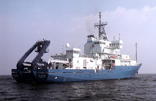
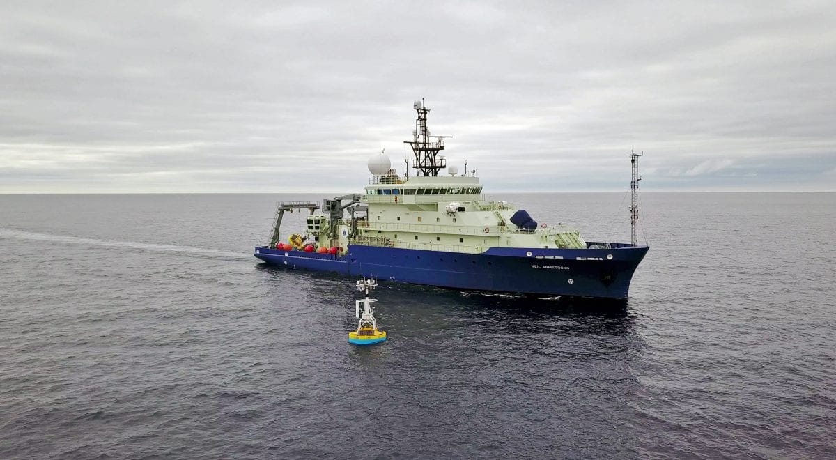
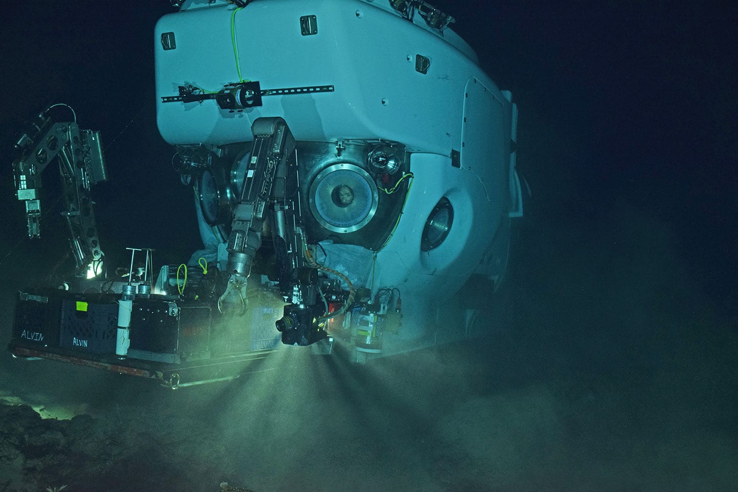
WHOI scientists, engineers, and students collaborate to develop theories, test ideas, build seagoing instruments, and collect data in diverse marine environments. Ships operated by WHOI carry research scientists throughout the world’s oceans. The WHOI fleet includes two large research vessels ( R/V Atlantis and R/V Neil Armstrong); the coastal craft Tioga; small research craft such as the dive-operation work boat Echo; the deep-diving human-occupied submersible Alvin; the tethered, remotely operated vehicle Jason/Medea; and autonomous underwater vehicles such as the REMUS and SeaBED.
WHOI offers graduate and post-doctoral studies in marine science. There are several fellowship and training programs, and graduate degrees are awarded through a joint program with the Massachusetts Institute of Technology. WHOI is accredited by the New England Association of Schools and Colleges . WHOI also offers public outreach programs and informal education through its Exhibit Center and summer tours. The Institution has a volunteer program and a membership program, WHOI Associate.
On October 1, 2020, Peter B. de Menocal became the institution’s eleventh president and director.
History
In 1927, a National Academy of Sciences committee concluded that it was time to “consider the share of the United States of America in a worldwide program of oceanographic research.” The committee’s recommendation for establishing a permanent independent research laboratory on the East Coast to “prosecute oceanography in all its branches” led to the founding in 1930 of the Woods Hole Oceanographic Institution.
A $2.5 million grant from the Rockefeller Foundation supported the summer work of a dozen scientists, construction of a laboratory building and commissioning of a research vessel, the 142-foot (43 m) ketch R/V Atlantis, whose profile still forms the Institution’s logo.
WHOI grew substantially to support significant defense-related research during World War II, and later began a steady growth in staff, research fleet, and scientific stature. From 1950 to 1956, the director was Dr. Edward “Iceberg” Smith, an Arctic explorer, oceanographer and retired Coast Guard rear admiral.
In 1977 the institution appointed the influential oceanographer John Steele as director, and he served until his retirement in 1989.
On 1 September 1985, a joint French-American expedition led by Jean-Louis Michel of IFREMER and Robert Ballard of the Woods Hole Oceanographic Institution identified the location of the wreck of the RMS Titanic which sank off the coast of Newfoundland 15 April 1912.
On 3 April 2011, within a week of resuming of the search operation for Air France Flight 447, a team led by WHOI, operating full ocean depth autonomous underwater vehicles (AUVs) owned by the Waitt Institute discovered, by means of sidescan sonar, a large portion of debris field from flight AF447.
In March 2017 the institution effected an open-access policy to make its research publicly accessible online.
The Institution has maintained a long and controversial business collaboration with the treasure hunter company Odyssey Marine. Likewise, WHOI has participated in the location of the San José galleon in Colombia for the commercial exploitation of the shipwreck by the Government of President Santos and a private company.
In 2019, iDefense reported that China’s hackers had launched cyberattacks on dozens of academic institutions in an attempt to gain information on technology being developed for the United States Navy. Some of the targets included the Woods Hole Oceanographic Institution. The attacks have been underway since at least April 2017.
